

The Peloponnese is a peninsula in southern Greece, a place full of mysteries and myths, archaeological sites and wonderful beaches, a place that has so much to offer so that it can please any type of traveller. So, if you have already been to Athens and now you are looking for another destination in Greece, I think you should give a chance to the Peloponnese – it will amaze you.
Below you can find our 8-day itinerary in Messinia and Laconia regions of the Peloponnese, including the Mani Peninsula.

We tried to find an equilibrium between the pleasure of going to the beach and the one of visiting archaeological sites or admiring the cultural heritage of the place.
Advice: For flexibility, you should definitely rent a car! This itinerary is not possible by using only public transportation. Moreover, you should get up early if you want to see so many places in just one week.
Day 1
Kalamata
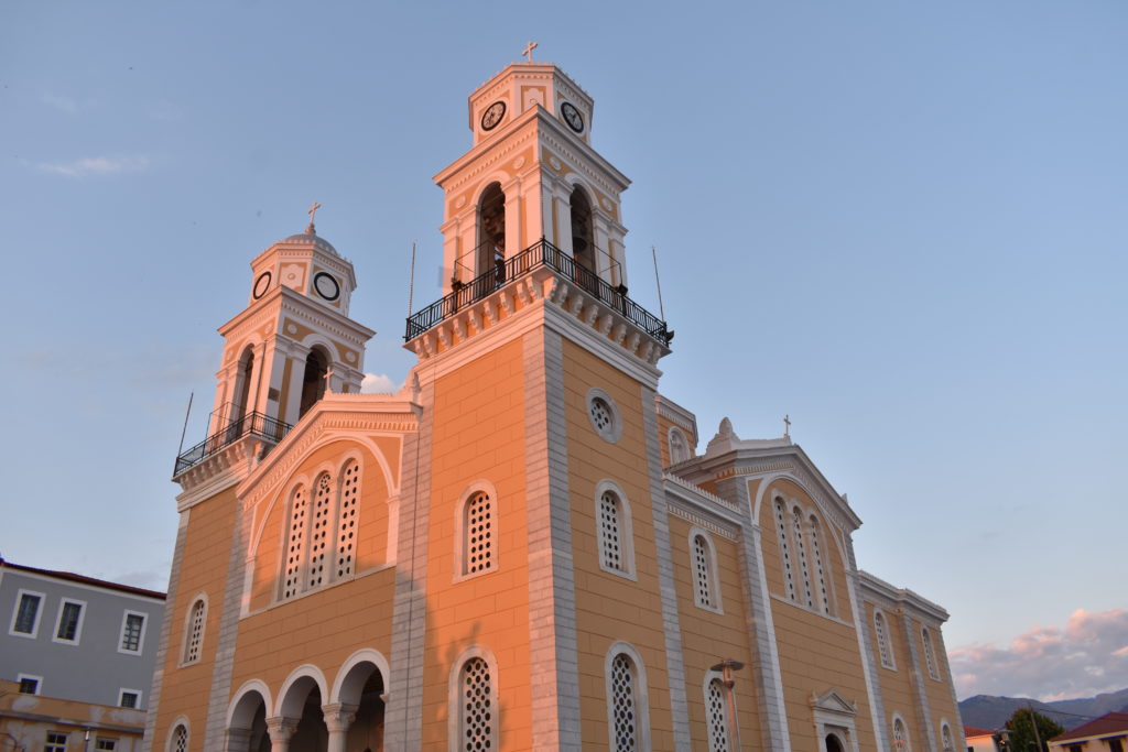
Kalamata was the starting and ending point of our trip. It is the capital and largest city of Messinia. Kalamata International Airport (situated about 11 km away from the city, in Messini), although very small, operates some international flights, as well as domestic flights to Athens and Thessaloniki. Kalamata Old Town, after having been almost destroyed by the Ottomans during the War of Independence and then rebuilt by French around 1830, was then destroyed again in 1986 by an earthquake. Miraculously, Kalamata’s Castle or the Kastro survived the earthquake and it can still be visited (entrance fee 2 €), offering a stunning view of the city.
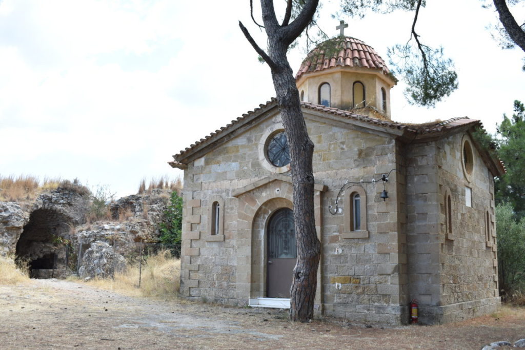

Another attraction you should not miss is the Church of Ypapantis, which hosts the miraculous icon of Virgin Mary, known as kalo mata (“good eye”), from which the city takes its name.
In Kalamata, you can enjoy a walk on the narrow streets, among souvenir shops and restaurants where you can taste a gyros or a Greek salad.
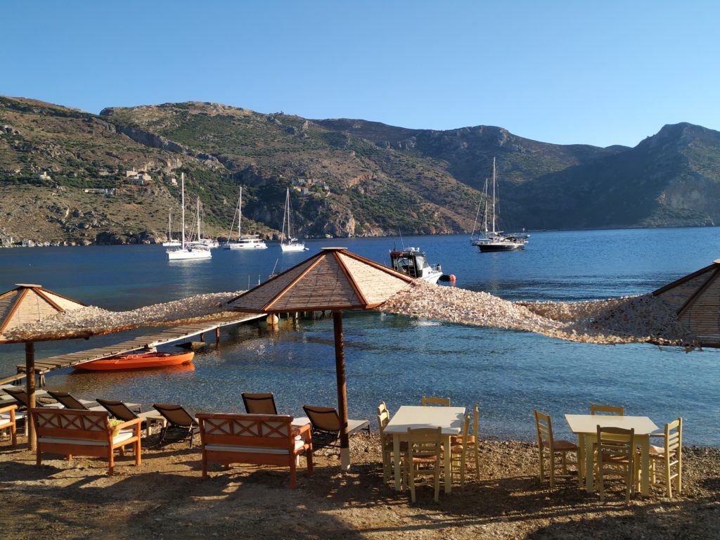
Regarding the beaches nearby, we have been to Bouka beach, in Messini, located 6 km away from the airport. This is a clean, sandy, blue flagged beach, but it was windy, so the water was quite wavy.

Day 2
Sparta – Mystras
From Kalamata to Sparta there is a 99-km drive. One option is to take the highway (like we did) and in this case you should know there are 3 road toll pay points, a total of about 5 €; another way is to take a road that crosses the mountains and is a bit shorter (86 km), but it takes more time to reach the destination, plus we heard that this road is quite dangerous.
Sparta is the capital of Laconia region. It is attractive for visitors due to the archaeological site of Ancient Sparta, which offers a glimpse of what once was fearless Sparta. Although the remainings of Ancient Sparta are few, it is worth visiting the site (and it is free!) and it is interesting to admire from above the “new” Sparta.


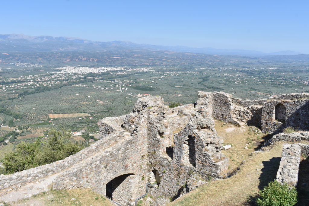
Mystras is about 6 km away from Sparta and the truth is that most of the people visit Sparta on their way to Mystras, because Mystras is a fortified town that served as the capital of the Byzantine Despotate of the Morea in the 14th and 15th centuries and it experienced great prosperity. The town is a huge complex of ruins (libraries, monasteries, palace, fortress), but there are also a few churches in good condition. In 1989, Mystras fortified town was named a UNESCO World Heritage Site.
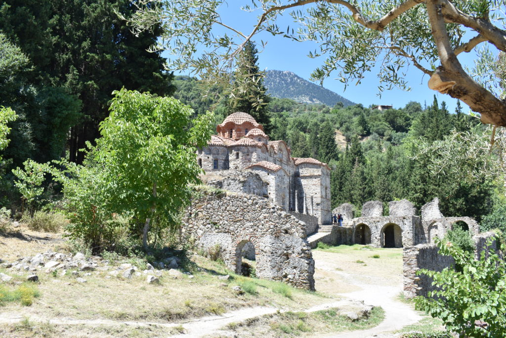
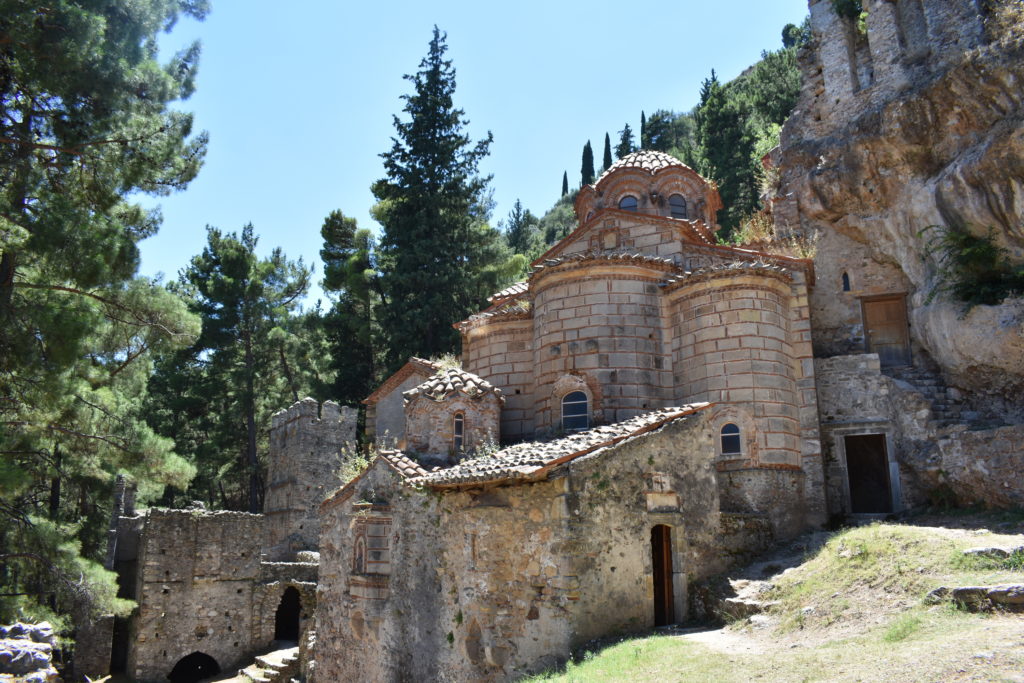
The entrance fee is 12 € and the visit takes at least 3 hours, so make sure you have comfortable shoes and water. For those of you passionate about history and architecture, this place will be a paradise. For the rest of you, it might be tiring, especially if it’s a hot summer day.
Day 3
Monemvasia – Kastania Cave
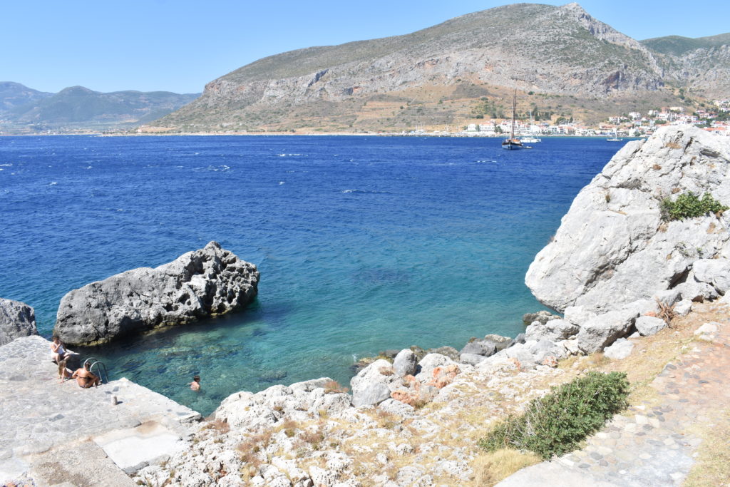
After the history lesson in Sparta and Mystras it’s time for some sea, right? But wait, in this place you can have both history and sea! There are 91 km from Mystras to Monemvasia and once you arrive there you will be immediately fascinated by the huge rock linked to the mainland (Gefyra) by a causeway. Monemvasia was actually part of the continent until 375 d.C. when an earthquake separated it, transforming it into an island.
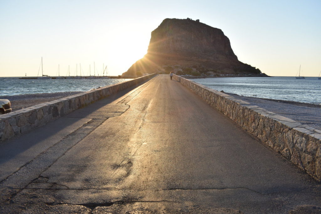
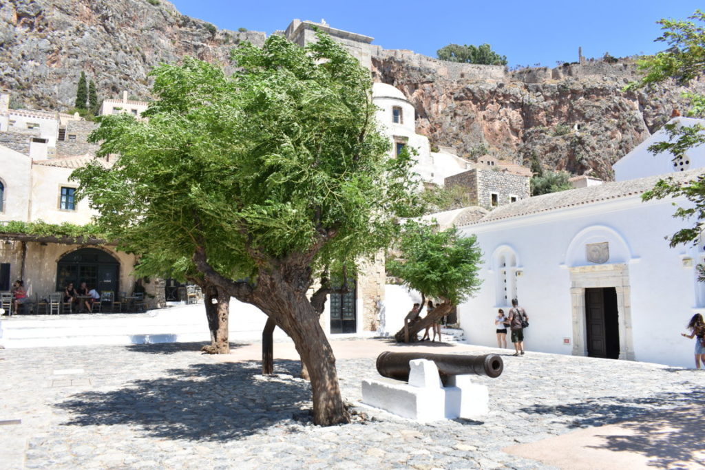
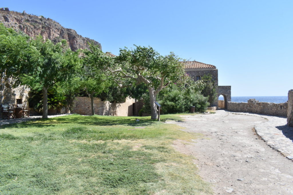
Monemvasia was a powerful medieval fortress and its area consists of a large plateau, about 100 m above sea level, 300 m wide and 1 km long. It is divided into Lower Town and Upper Town. We saw only the Lower Town because we were quite tired and short of time for going to the Upper Town as well. You can reach the Lower Town by foot, by car (if you are lucky enough to find parking near the entrance – vehicles are not allowed inside the fortress!) or by shuttle bus (every 30 min, price 1,10 €). We chose walking so that we could enjoy the view better.

Once arrived up, you will find yourself in a labyrinth: narrow alleys, flowers, hotels, restaurants, souvenir shops, churches, nude colours, the fortress walls, from where you can see the crashing waves. It seems a fairytale. Monemvasia is Mont-Saint-Michel of Greece or the Gibraltar of the East, as some say. It is my favourite city in Peloponnese, from the ones that I have seen so far.
On the way back to the mainland, we stopped to swim in a wonderful “private pool” with clear, turquoise water, which was great after 2 hours of visiting.
A must-see attraction in the area is Kastania Cave, situated about 38 km away from Monemvasia. It is one of the most impressive caves in Greece and it has a rich variety of colours, shapes and figures. I had never seen a cave like that before. There is a small parking lot in front of the main gate, a bar where you can have a snack while waiting for the next tour to start and there is an English speaking guide. For prices and timetable, you can click here. It is not allowed to take photos inside the cave.
Days 4 and 5
Elafonisos
Elafonisos is a small island with an area of 19 square kilometres, with wonderful sandy beaches and crystal clear waters, to which you can arrive by taking the ferry from Pouda/Pounta (from Monemvasia to Pouda there are about 35 km). The ferry ride takes only 8-10 minutes. For prices and schedule, you can check here.
Before telling you about Elafonisos, you should know that between the beach of Pouda and the islet of Pavlopetri, there is the submerged town of Pavlopetri, one of the oldest submerged towns in the world. It is situated in shallow waters, visible at a depth of about 3 meters, so for those of you who are into diving and have the necessary equipment, this is a must-do activity.
Now, about Elafonisos – it is a beach paradise! Extremely similar to Elafonissi beach in Crete!
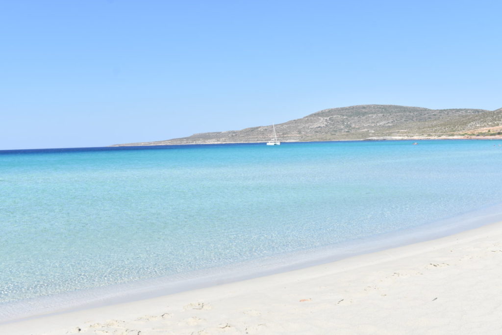
The most famous beach on Elafonisos island is Simos, located in the south-east part of the island. I guess the photos below say everything.
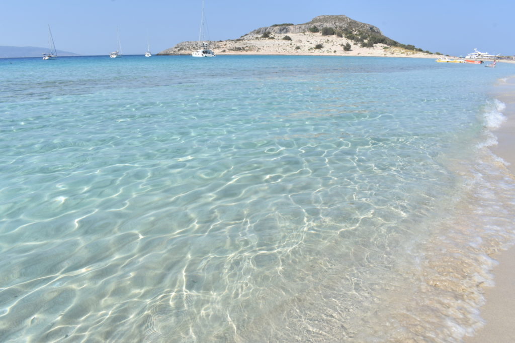

I noticed the most of the people go to the beach after 11 AM, so if you go in the morning, at about 9 AM (like we did), you can have the beach only for yourselves. Near the rocky parts, you can do snorkelling, surely you can see some fish. There are some restaurants nearby, so lunch and refreshments will not be a problem.
Close to Simos, but opposite, to the East, there is Leyki beach, a smaller, rocky beach, with wavy turquoise water, more suitable for snorkelling. Few people go there, so if you are looking for privacy, then this is for you.

The second most famous beach in Elafonisos is Kato Nisi, situated on the western part of the island.
A forth beach would be Kontogoni, located in the North, just a few meters away from the many hotels and restaurants in the area. Although not as beautiful as the other beaches, it might be preferred by those who don’t have a car.
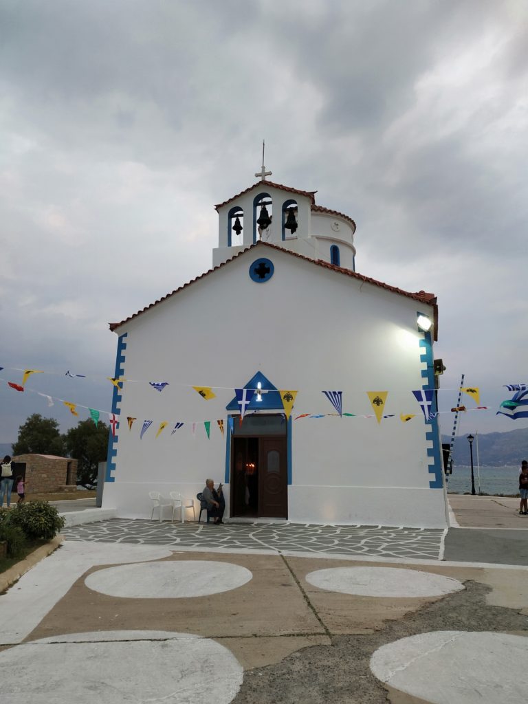
Except for the beaches, the vivid, animated part of Elafonisos is the North, full of restaurants, hotels, souvenir shops. There is also a small, beautiful church. Having a walk at twilight can be a nice and enjoyable experience.

Day 6
We spent 2 nights in Elafonisos and we consider that was enough to explore it. We took the ferry back to Pounta and continued our journey towards the Mani Peninsula, but our first stop was Gythio.
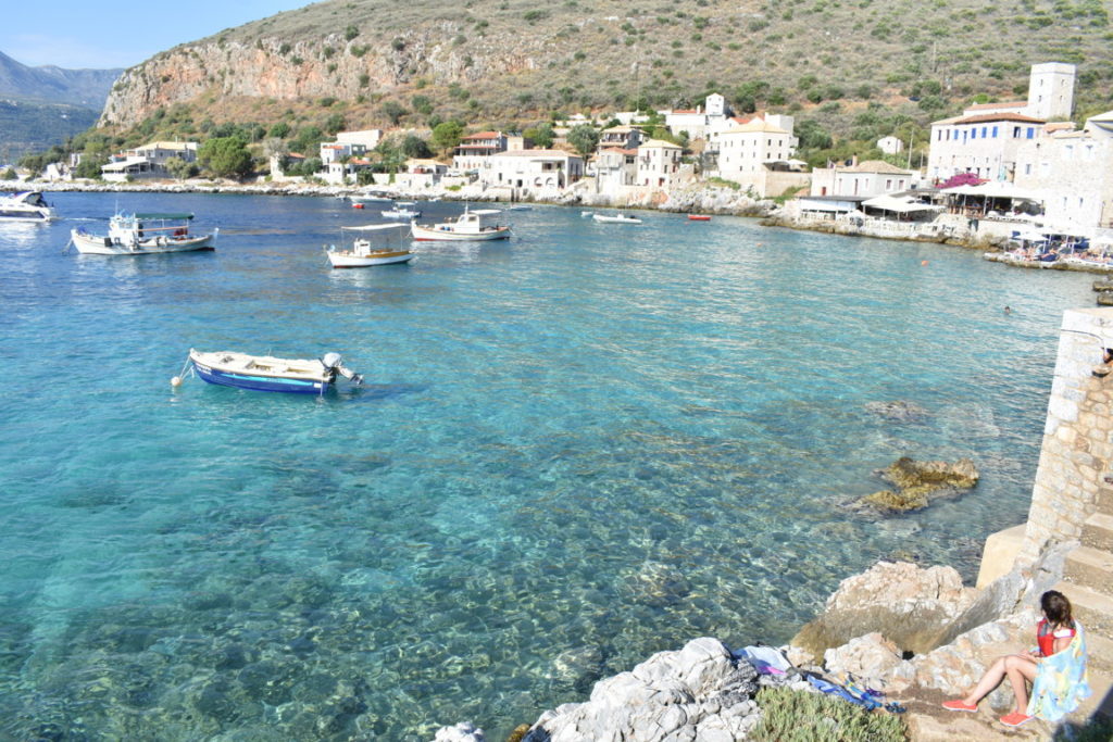
Gythio
Gythio is a fishermen village, with colourful houses, perfect for a stop on your way to Mani. From Pounta to Gythio there are 87 km.

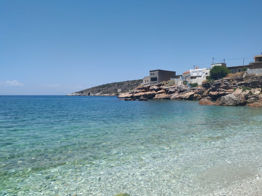
Kiparissos
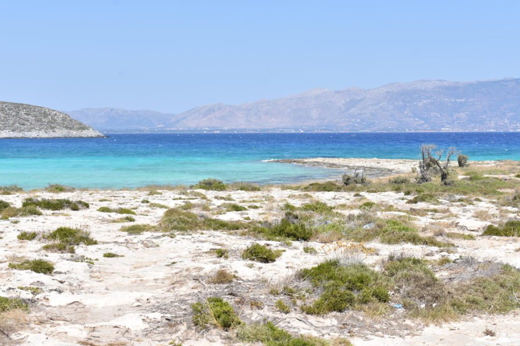
From Gythio, we followed the road to Areopoli, about which I will talk later, and then down to Porto Kagio where we had booked accommodation. But on the way, just 4 km before Vathia, we found a great beach in Kiparissos and we couldn’t help but stop for a bath. Here is the view from above:

Rocky beach, warm water, suitable for snorkelling. Of course, don’t expect to be like in the Caribbean Sea. We saw only one type of colourful fish – the rest were common fish, crabs, sea urchins and even eels. Make sure you wear water shoes!
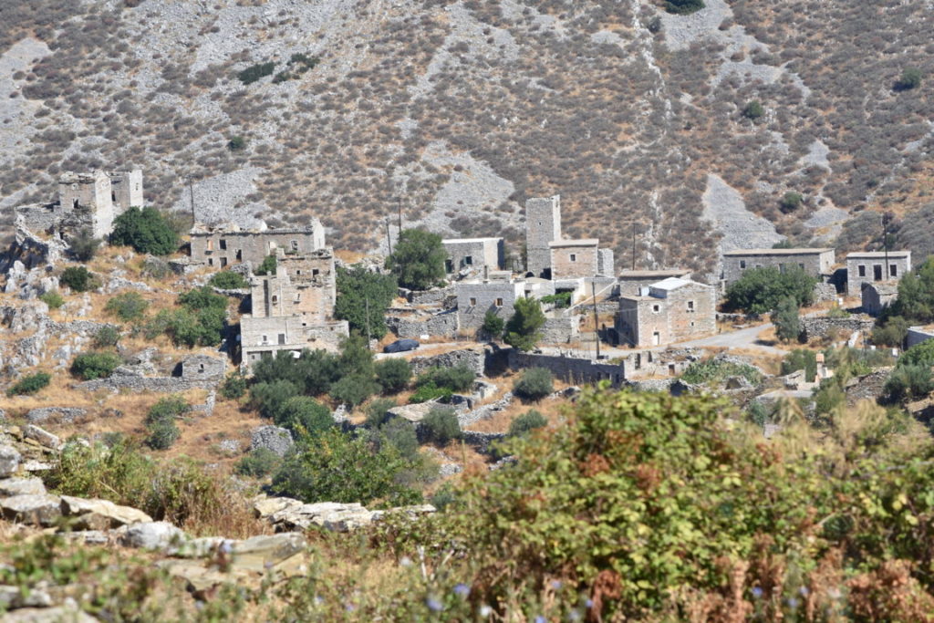
Vathia
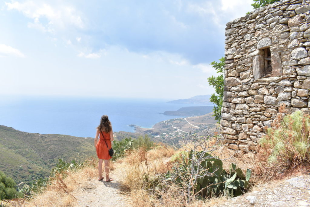
As I said, Vathia is 4 km away from Kiparissos and about 60 km away from Gythio. Vathia is maybe the most famous and photographed traditional village on the Mani Peninsula, due to its tower-houses built on a hill. It is an iconic example of the south Maniot architecture, developed during the 17th and 19th century when the region was dominated by different clans being in rivalry one with another, so they built tower-like houses to protect themselves better from the enemy. You can see such tower-like houses either isolated or grouped as villages. Most of them are abandoned, but some are still inhabited or have been restored and transformed into hotels or restaurants.
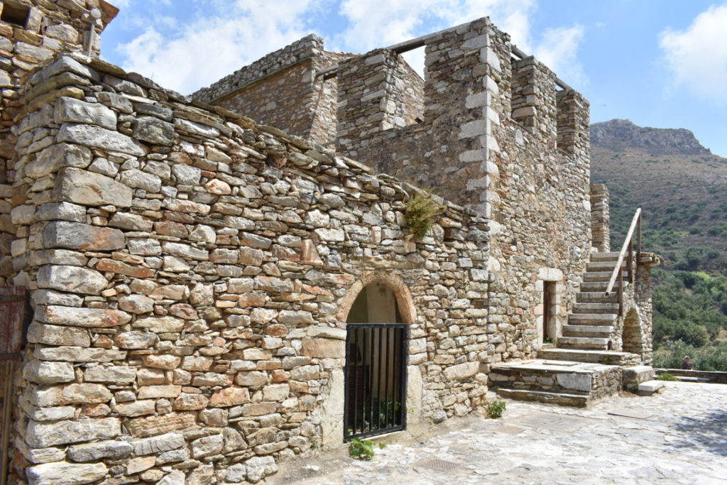
Vathia is like a ghost-village, a labyrinth of old abandoned tower-houses, except for one house that is still inhabited by an old woman. Vathia can be visited for free. After the visit, you can enjoy a drink or a meal at the restaurant across the road, offering a scenic view of the village and the surrounding hills.

Porto Kagio
Porto Kagio is a very small fishermen village located 5 km away from Vathia and faces a small bay off the Laconian Gulf. It is very peaceful, although its main economy is tourism. It is perfect for spending one night and enjoying a delicious fish-based dinner right on the seaside.

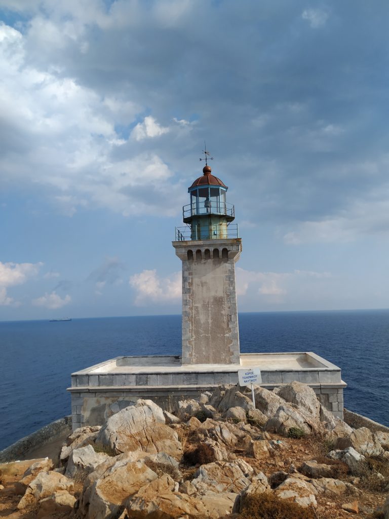
Cape Tenaro/Tainaro/Matapan
The reason why we booked accommodation in Porto Kagio is that this was a convenient starting point for reaching the southernmost tip of the Mani Peninsula and mainland Greece – Cape Tenaro, known also as Cape Tainaro or Matapan. It is the second southernmost point in mainland Europe.
To arrive there from Porto Kagio, first you have to drive to Kokkinogia, about 5,5 km, and then continue on foot, following the beaten path, for about 2 km. It takes about 30-40 min per way because the path is mainly rocky. Make sure you wear comfortable shoes, take enough water and use sun cream because during summer days the sun burns pretty badly even at 6 pm. Actually, I recommend doing this after 6 pm, to avoid the heat.

It’s worth the effort, believe me! I admit I complained a bit on the way and wasn’t sure if that was worth it, but once arrived at the lighthouse, I felt really proud and excited that I had reached that point. You can enjoy stunning views of the sea, cliffs and hills and, after returning to Kokkinogia, you can chill by jumping into the refreshing water of the local beach. That would be a good end of a day full of activities, right?
Day 7
On the way from Porto Kagio to Areopoli (about 40 km), we tried to alternate the beaches with the traditional villages with tower-houses, so we saw one village, then one beach, then a village again and so on. However, if you are not so much interested in history, culture, architecture, then you might find yourself bored visiting so many villages because even if some are big, some are small, some are inhabited, some not, they have more or less the same style. Anyway, it’s your choice if you want to focus more on beaches or not. Here below you can see where we have been:
Mountanistika
18 km away from Porto Kagio and accessible from Alika. It is a small, almost abandoned village where you will surely not find any other visitors. This is also because the road leading up there is very winding and quite narrow and dangerous in some parts, so take care!

Gerolimenas
10 km away from Mountanistika. You can find a rocky beach with clear turquoise water and quite a few restaurants waiting for you to taste their fish dishes.

I need to mention that all the beaches that we have seen on our way from Porto Kagio to Areopoli, so on the western part of the Mani Peninsula, are all the same kind: rocky, with clear green/turquoise waters, suitable for snorkelling, as there is quite a rich variety of fish in the area. If you can’t swim, but still want to fully enjoy these beaches, then you should have the proper equipment (like me :D): water shoes, life vest, snorkelling mask. With these, you can venture into the deep water to search for fish, even if you can’t swim. Believe me, I tested it myself!
Kitta
Another “stone” village, located about 5 km away from Gerolimenas.
Mezapos
6 km away from Kitta. A rather secluded beach where you can find 2 small caves.

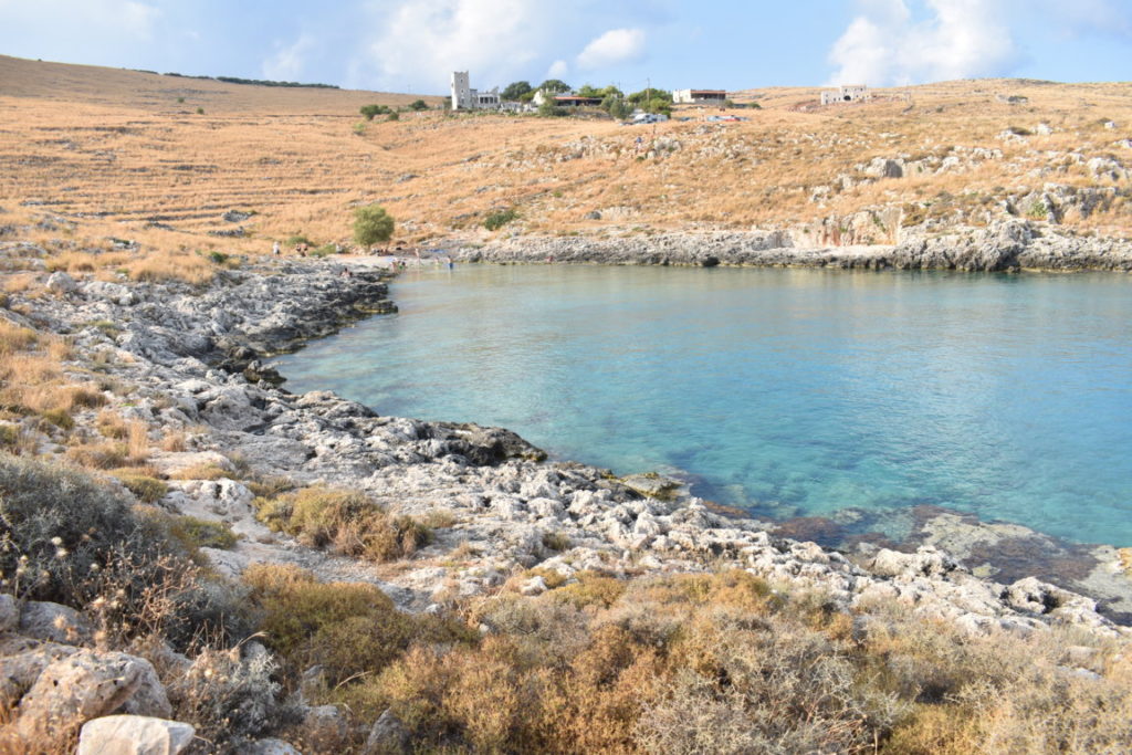
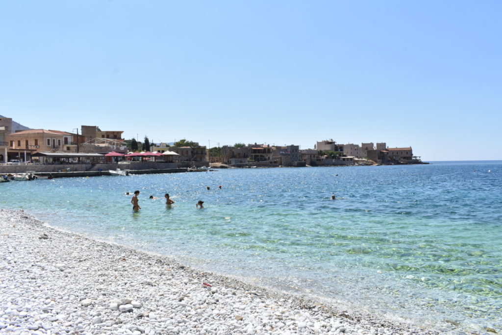
Limeni
We had accommodation in Areopoli, but first we went to Limeni (23 km away from Mezapos), a small picturesque village known for its green waters and for the restaurants that provide grilled fresh fish, so fresh that, if you are lucky enough, you can even see the fisherman catching it in front of you. I am not kidding – there was a man catching and then peeling the fish right there. The price per kg varies depending on the kind of fish you want, but the average is about 55 €/kg.
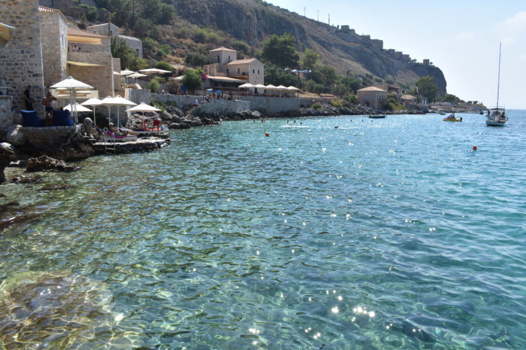
We even saw 2 huge sea turtles in the water, the only place in Greece (so far) where we saw. Unfortunately, we were not fast enough to grab the camera and take a photo of them.
Although very small, Limeni is quite touristic, many people were trying to find a place somewhere on the rocks, since there is no proper beach there, but rather big rocks. Luckily, we found a place just for us:
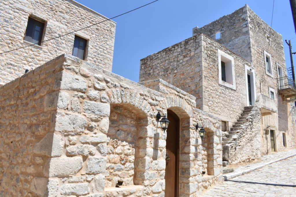
Areopoli
Areopoli is only 6 km away from Limeni and it takes its name from Ares, the god of war. Our hotel was a tower-house. We had seen so many tower-houses that eventually we had to sleep in one, right?
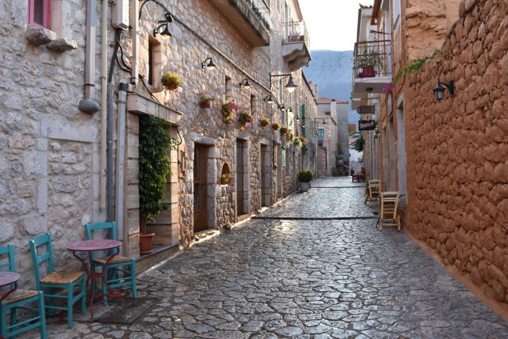
The old town of Areopoli is extremely vivid especially in the evening, with tourists wandering on the paved narrow streets. The place is crawling with restaurants and bars, each of them trying to attract the tourists with a unique design. Actually, we have seen sooooo many restaurants that we were wondering if there are ever enough tourists there to fill them all because eventually most of them remained empty.
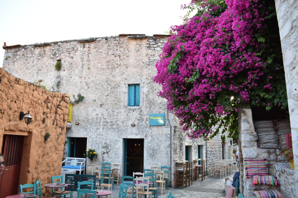

Having a stroll in Areopoli at sunset was great, before our return to Kalamata.

Extra: An attraction worth visiting in the area is Diros Cave. Unfortunately, we didn’t have time for it anymore and we didn’t necessarily want to visit it since we had already seen Kastania Cave. But Diros Cave is different because is accessible only by boat. You can reach it by following the signs from the village Pyrgos Dirou. The guide speaks only Greek, so if you can’t speak Greek, prepare for a silent 30-min boat ride, followed by other 300 m on foot, inside the cave. The official site is in Greek only, but for information in English, you can check here. If you visit Diros Cave, please share with us your impressions.
Day 8
81 km from Areopoli to Kalamata. Although we had seen Kalamata on day 1 as well, this time we just shopped for some souvenirs, took the last photos and had a last Greek lunch.
All in all, it has been an amazing trip, we have seen so many places and surely we want to explore some other parts of Greece.
I hope this has been useful to you and I promise you will not regret if you visit the Peloponnese!